Seoraksan, South Korea


Biryong (Flying Dragon) Waterfalls in
Seoraksan National Park.
Seoraksan is the highest mountain in the Taebaek mountain range in the Gangwon province in eastern South Korea. It is located in a national park near the city of Sokcho. After the Hallasan volcano on Jeju Island and Jirisan in the south, Seoraksan is the third highest mountain in South Korea. The Daechongbong Peak of Seoraksan reaches 1,708 metres (5,603 feet). The Taebaek mountain chain is often considered the backbone of the Korean peninsula.

The national park attracts many national and international tourists all year round, but the main season for Seoraksan national park is autumn. The autumn colours in the area are considered amongst the most beautiful in Korea. The red and yellow forest is interrupted by rocks and small mountain streams flow amidst this. During the rainy season in summer—especially after a typhoon—these streams can swell.

Bronze Buddha of Sinheungsa (Buddhist Temple)
near the main
entrance to Seoraksan National Park.
Perhaps the most visited part of the mountain is the main entrance valley to the National Park, a fifteen minute drive from Sokcho city. The valley runs west to east with a paved road leading up to the park's entrance gate. This valley contains many beautiful sites and is well worth a day visit.

The Yukdam waterfall and the Biryeong waterfall are located on the left side of the valley, about a forty minute walk from the main car park. Ulsanbawi is a rock formation in the Seoraksan national park. The shape of Ulsanbawi is unique in the area. To reach the rocks you need to follow a hiking path and climb over 800 steps (it's actually 888 steps according to locals). On the way there, there are two temples and a spherical rock, Heundeulbawi, which is located on top of a larger rock. This rock is about 5 metres (16 feet) high and can be moved with some effort. Thousands of people have already tried to push down Heundeulbawi, but nobody gets further than waggling the rock.

According to the legend Ulsanbawi comes from the city of Ulsan in the south east of Korea. As Kumgangsan was built, Ulsanbawi walked to the north as the representative of the city. Unfortunately Ulsanbawi arrived too late and there was no more room. Ulsanbawi was ashamed and slowly trudged back to the south. One evening the rock went to sleep in the Seorak area. Ulsanbawi felt it was so beautiful around there that it decided to stay for good.

Seoraksan National Park
Seoraksan
Sinheungsa (Buddhist Temple) in
Seoraksan National Park
Ulsanbawi (peak) in Seoraksan National Park

At the end of the main valley is Biseondae, a rock platform in a stream. Above the stream is a difficult to reach cave, which offers clear views of the surrounding rock formations.

A bit farther from the entrance is the Valley of a Thousand Buddhas , the primary valley of Seorak Mountain, also sometimes referred to as Seorak Valley. The valley was so named because the rock formations that line its sides resemble a line-up of Buddha statues.

Mount Gwonggeumseong in Seoraksan National Park

63 Building, South Korea


63 Building in Seoul
The 63 Building , officially the 63 City, is a skyscraper on Yeouido island, overlooking the Han River in Seoul, South Korea. At 249 meters (817 ft) high, it was the tallest building outside North America when completed in 1985, but as of 2010 is no longer in the top 100. It was South Korea's tallest building until Hyperion Tower surpassed it in 2003 and remained South Korea's tallest commercial building until the Northeast Asia Trade Tower was topped-out in 2009. The 63 Building was a result of a building boom in South Korea. 63 refers to the building's 63 official stories, of which 60 are above ground level and 3 are basement floors. The skyscraper is the headquarters of Korea Life Insurance, Industrial Bank of Korea Securities, and other major financial companies.

The 60th floor houses the world's tallest art gallery and an observation deck known as 63 Golden Tower, that allows visitors to see as far as Incheon on clear days. The 59th floor features international restaurants called Walking in the Cloud, while the 58th floor houses family restaurants called Touch the Sky. Observation elevators equipped with windows enable their passengers to view the city as they ride up to (or down from) the observation deck. In the evening, some elevators are available for only couples, called the Love Elevator, which gives them a 1 minute exclusive ride. The lower floors house an indoor shopping mall with approximately 90 stores, an Imax Theater, and a large aquarium. A convention center and banquet hall are also housed within the building. In July 5, 2009, a wax doll museum opened in third and fourth floor basement, which features real statutes of famous people in the world.

The 63 Building was featured in the computer games SimCity 3000 and SimCity 4, and featured on the cover of SimCity 3000 Unlimited.

A view of Han River & 63 Building

A view of Youido with dawn


The 63 building just before sunrise on new years day 2010

What Are South Korea's Famous Tourist Attractions and Activities?


Gyeongju
Korea's ancient capital, Gyeongju, is the country's big must-see, and rates as one of the ten most important ancient cultural cities in the world. In among the shops and markets in the modern-day city you'll find abundant relics of its two-thousand-year history, including colossal fifth-century tombs and burial mounds, a seventh-century stone observatory, and the royal pleasure gardens of Anapji, which were designed in 674 AD. Other quarters of Gyeongju are rich with elegant pagodas and historic wooden Buddhist temples, and numerous trails take you to the slopes of the sacred mountain, Nam-san, which dominates the south of the city.

View images of Anapji

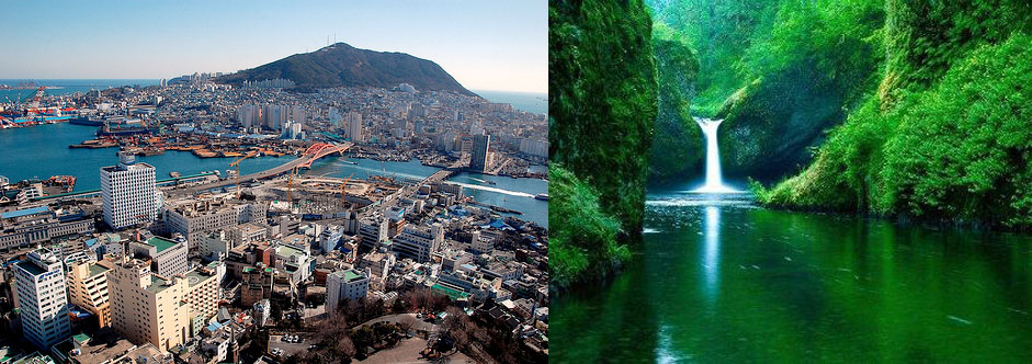
Hiking in the national parks
South Korea is full of exhilarating national parks, all of which are crisscrossed by clearly marked trails and dotted with good camping spots (and the occasional mountain hut). The cream of the crop is Seorak-san, and in particular Naeseorak (Inner Seorak), an exceptionally tranquil stretch of forested peaks, rivers, waterfalls and Buddhist temples - and some established rock climbs too. Also well worth seeking out are Jiri-san, which boasts a 65-kilometre-long ridge trail and lots of historic temples; the popular and fairly gentle trails of Songni-san; and Bukhansan, which is on the edge of Seoul.

Seoul
South Korea's modern day capital has a reasonable number of sights to keep you entertained for a few days. Most interesting are the five imposing royal palaces, some of which date back to the fifteenth century. Inside the Changdokkung Palace you'll find one of South Korea's loveliest gardens, the Piwon, a beautifully landscaped haven of ponds and pavilions. In the modern part of town, check out the Kimchi Museum, dedicated to fiery pickled cabbage that is South Korea's national dish, browse the cutting-edge Leeum Museum of Modern Art, and spend the evening in the trendy nightlufe district of Sinchon.

Panmunjeom
On the 38th parallel, the 1953 ceasefire line between North and South Korea - a four-kilometre-wide strip of land spiked with guardposts - is still in force today, and the village of Panmunjeom, which stands on the DMZ just 56km north of Seoul, is a popular day-trip from the capital. Unless you can afford the cost of joining an organized tour around North Korea, this is the closest you can get to the repressive, desperately impoverished totalitarian state. There's no border crossing here (or anywhere between the two countries) but Panmunjeom attracts busloads of tourists, all of whom required to dress smartly (No jeans, T-shirts or miniskirts) and, if male, to have a respectable haircut!

View images of Panmunjeom

The KoreanFolkVillage
It may sound like a coach tour nightmare, but the Korean Folk Village is well worth a day-trip from Seoul, especially if you've not got time to explore the rest of the country. A reconstruction of a typical nineteenth-century village, it's complete with Buddhist temple, Confucian school, pottery and weaving workshops, blacksmiths and traditional farmhouses. The people you see in the village do actually live and work there, even if they might look like actors dolled up in traditional outfits.

Jeju-do
This southern island has maintained traditions that have long disappeared from the mainland and is now a popular tourist destination as well as a favorite with local honeymooners. Highlights here include mysterious Easter Island-like statues, hikes to the summit of Halla-san (South Korea's highest volcano), and a seven-kilometer-long lava-tube cave. The climate down here is warmer and wetter that in the rest of the country, but don't come specifically foe the beaches, as you'll find them crowded and disappointingly scruffy

Click here to book flights to South Korea with Zuji

The three-hour boat ride from Busan to Yeosu
This is one of the most scenic journeys in the country, with fine views of the crenellated coastline and myriad islets. It's so attractive round here that the whole area has been conserved as Hallyo Waterway National Park

The island of Ulung-do
Rugged, remote and starkly beautiful, this tiny volcanic outcrop - accessed by ferry from Samcheck - has hardly any roads and is best explored on foot. It takes two days to walk right round the island, giving you ample opportunity to enjoy the temples. Forested ridges, waterfalls and famous 2000-year-old juniper tree

Taking an open-air bath with a view at Seorak Waterpia
Soak up the glorious mountain vista while wallowing in the natural hot springs at this spa resort in Seorak-san National Park, where you can also bathe in a lemon flavoured pool, go skinny dipping, and brave a shower under a near-boiling waterfall

The fifteenth-century village of Yangdong
Prettily set beside a river and beneath a wooded hill, Yangdong is of such historic importance that villagers are forbidden to modify or knock down their antique wooden houses, many of which are magnificent structures with sweeping roofs, beautifully carved beams and capacious verandahs.

View Images of  Yangdong

Bargain-hunting at Namdaemun Night Market in Seoul
Opening every night at around 10.30pm and running through till just before dawn, the enormous Namdaemun Market sells everything from handicrafts to saucepans, ginseng to live fish. It's a great place to while away the evening, not least because of all the cheap food stalls that dish up hot snacks through till morning.

Staying in a yogwan
If you're on a budget, make a beeline for these traditional questhouses: they're cheap, family-run, and usually have lots of character. You sleep on a futon on the floor - a special treat in winter when the underfloor heating system kicks in and acts like a huge electric blanket

Snowboarding and skiing at Yongpyong
There are over thirty runs for skiers and snowboarders at this trendy ski resort on the slopes on Mount Balwang, plus floodlit night skiing, a sledging park and cross-country trails. Also holds a snow-sculpture festival in February

Click here to book flights to South Korea with Zuji

Gangnam, Seoul, South Korea


View of gangnam,seoul, south korea
Teheran Ave in Gangnam-gu, Seoul, South Korea
  Gangnam-gu is one of the 25 gu (local government districts) which make up the city of Seoul, South Korea. It is one of the most affluent areas of Seoul and is located in the southeast of the city. It is served by Seoul Subway Line 2, Seoul Subway Line 3, Seoul Subway Line 7 and the Bundang Line.

Several popular shopping and entertainment areas are located in Gangnam-gu, including Apgujeong, the COEX Mall and the area around Gangnam Station. The important business district around Teheranno (Tehran Street) runs east-west from Gangnam Station to Samseong Station and the COEX-KWTC complex.


Taken from 52nd Floor of Seoul' World Trade Center - A view towards the Han River

Banpo Bridge, Seoul


The Banpo Bridge is a major bridge in downtown Seoul over the Han River, South Korea, connecting the Seocho and Yongsan districts. Banpo Bridge is on top of Jamsu Bridge, forming a "double deck" bridge. When the water level rises too high, the Jamsu Bridge becomes covered with water and gets closed off. The lower deck incorporates pedestrian and bicycle paths that provide easy access to the Banpo Hangang Park from the north side of the river. Banpo Bridge is a girder bridge and was completed in 1982.

Moonlight Rainbow Fountain


The Moonlight Rainbow Fountain is the world's longest bridge fountain that set a Guinness World Record with nearly 10,000 LED nozzles that run along both sides that is 1,140m long, shooting out 190 tons of water per minute. Installed in September 2009 on the Banpo Bridge, Seoul mayor Oh Se-hoon praised that the bridge will further beautify the city and showcase Seoul's eco-friendliness, as the water is pumped directly from the river itself and continuously recycled. The bridge has 38 water pumps and 380 nozzles on either side, which draw 190 tons of water per minute from the river 20 meters below the deck, and shoots as far as 43 meters horizontally

Bukhansan, Seoul, South Korea


A view from Daesumgmun in Bukhansan
A view of a shrine on the Bukhan Mountain
A view of Bukhansan
Bukhansan, mountain located on the north side of Seoul

Bukhansan
Daenammun gate of Bukhansan
Daesumgmun of Bukhansan
Insoo Peak in Bukhan Mountain


Bukhansan, or Bukhan Mountain, is a mountain on the north side of Seoul, South Korea. A significant section of Seoul is bordered by Bukhansan, which is a major landmark easily visible from most of the city. The mountain is 836.5 meters above sea level. Its name means "north Han mountain," and refers to its location to the north of the Han River. It also is the marker for the Northern boundary of Joseon Seoul. Bukhansan, and Bukhansan National Park of which it is a part, is a popular tourist attraction in the Seoul area. It is known as one of the preferred destinations for birdwatching and hiking in the Seoul metropolitan area.

Panmunjeom, South korea

Three ROK soldiers watching the border
at Panmunjeom in the DMZ
between North and South Korea
North Korean Soldiers guard the
border marked by a short concrete threshold.

Conference rooms straddling the demarcation line
The village of Kijong-dong, on the North Korean
side of the DMZ

The joint security area seen from the north side

A South Korean military base on the south side
of the demilitarized
zone, as seen from a North Korean bunker
The Dorosan observatory

Yangdong Folk Village, South Korea


Yangdong Folk Village (Yangdong Village of Gyeongju) is a traditional village from the Joseon Dynasty. The village is located in Gangdong-myeon, sixteen kilometers northeast of Gyeongju, Gyeongsangbuk-do, South Korea, along the Hyeongsan River. Mt. Seolchang stands to the north of the village. The village is designated as Important Folklore Materials No. 189 by the South Korean government.

The size, degree of preservation, numerous cultural assets, traditionalism, beautiful natural setting all contribute to the importance of Yangdong Village. It is also a fine example of the yangban (Korean aristocracy) lifestyle and Neo-Confucian traditions.

The village is listed by the South Korean government with UNESCO as a World Heritage site with Hahoe Folk Village in 2010.

Overview
A man in hanbok, traditional Korean costume weaving a basket in Yangdong village

The village was founded by Son So. The household of the Wolseong Son clan was placed on an auspicious site according to Korean theories of pungsu (geomancy). Son So and his wife, the daughter of Yu Bok Ha had a daughter who married Yi Beon of the Yeogang Yi family. The marriage produced one of the eighteen sages of Korea, Yi Unjeok. The village of Yangdon has continued since its auspicious beginning in the 15th century.

Although some of the village is unoccupied today, the overall the village has over 160 tile-roofed and thatched-roof homes built throughout the dense forest. Fifty-four historic homes over 200 years old have also been preserved. The village preserves folk customs as well as traditional buildings of traditional Joseon Dynasty architecture. Seobaekodang is the primary home of the Wolseong Son Family. Mucheomdang, is the primary house of the Yeogang Yi family. Hyangdan. Ihayangjeon and Simsujeong pavilions, and the Ganghakdang village school are also notable structures of the village as well as Gwangajeong and Sonsoyeongjeong. Tonggamsokpyeon, a book printed on movable metal type, is also held at the village.

Important folk materials at the village include: Seobaekdang , Nakseondang , Sahodang , Sangchunheon , Geunam Manor , Dugok Manor , Sujoldang , Ihyangjeong, Suunjeong, Simsujeong, Allakjeong, and Ganghakdang.

Other cultural properties include: Jeokgae Gongsin Nonsang Rokgwan, Sonso’s Will, Pine Tree in Yangdong, Daeseongheon, Son Jong-ro Jeongchungbigak, Gyeongsan Seodang, Dugok Yeongdang.

The village follows the topography of the mountains and valleys and is shaped like an auspicious Hanja character. This arrangement has been carefully preserved. The homes of the Wolseong Son and Yeogang Yu clans, as well as their descendants' homes are located on the high ground of the mountains and valleys. The lower class homes, characterized by their thatched roofs were built on lower ground. The village's organization highlights the severe social stratification characteristic of Joseon Dynasty society. Prince Charles visited Yangdong in 1993

Anapji, Gyeongju, South Korea


A reconstructed pavilion at Anapji lake
Anapji Pond facing
the Banwolseong palace sites


Anapji at night with reflections

Anapji, an artificial pond
Anapji, or Anap Pond is an artificial pond in Gyeongju National Park, South Korea. It was part of the palace complex of ancient Silla (57 BCE - 935 CE). It was constructed by order of King Munmu in 674 CE. The pond is situated at the northeast edge of the Banwolseong palace site, in central Gyeongju. It is an oval shape; 200m from east to west and 180m from north to south. It contains three small islands.


History

Anapji was originally located near the palace of Silla called Banwolseong. It is written in Samguk Sagi: "During the era of King Munmu, a new pond was made in the palace and flowers and birds flourished in this pond". There is also mention of a royal reception held by King Gyeongsun in 931, when Silla was already crumbling. After the fall of Silla, the pond fell into disrepair for many centuries. The name Anapji appears in the 16th century Joseon era document Augmented Survey of the Geography of Korea with the explanation that King Munmu made the pond with Taoist aesthetics.


Renovation and excavation of relics

As part of the renovation project of historic sites in Gyeongju, Anapji was dredged and rebuilt in 1974. The long-term excavation project from March 1975 to December 1986 released a large number of relics from the pond. Research revealed that the pond had been surrounded by stone walls, and that 5 buildings had been standing on the pond's west to south sides. Waterway systems were also detected. Almost 33,000 pieces of historic relics were excavated from the site. An abundance of unique and extraordinarily designed roof tiles, architectural materials, pottery, gilt bronze figures of Buddha, jewelry, accessories and other everyday items were discovered, offering an insight to Buddhist art and everyday life in Silla.


Tourist destination

Anapji is currently allotted in Inwang-dong, Gyeongju and is part of Gyeongju National Park. Approximately 730 relics are on display at the Anapji Exhibition Hall, the special gallery of the Gyeongju National Museum. The site of Imhaejeon is also a part of the grounds, the most important building on the property and the structure used as the crown prince’s palace. While some sites have been restored others have been left in the natural form